

The disturbance that we began previewing in this newsletter over a week ago and that was first mentioned by NHC on Wednesday is now centered over the Bay of Campeche in the extreme southern Gulf.
The low-pressure area is an amalgamation of the remnants of Tropical Storm Cristina that crossed Central America from the eastern Pacific over the past few days and a westward-moving tropical disturbance. As of Friday morning, the low-pressure area remained broad and thunderstorm activity was disorganized.
Because the disturbance is situated so far south in the lower reaches of the Gulf and Bay of Campeche, there’s a small window today and Saturday for it to overperform and become a short-lived tropical depression or storm (Arthur, in the off-chance it’s named), but odds are stacked against it given the presence of dry, continental air to the west and a curtain of wind shear to the north.
Regardless, significant development isn’t expected before the system moves inland over northeastern Mexico late Saturday into early Sunday.
But wait, there’s more…
As we discussed in yesterday’s newsletter, the newcomer AI models suggest residual spin from the disturbance could re-emerge back over the northern Gulf south of Texas come the early to middle part of next week, where a stalled front could help to energize it and deflect the low-pressure area eastward toward the north-central Gulf Coast.
This is reflected in a handful of scenarios in both Google’s DeepMind machine learning-based model and the European Centre’s AI ensemble system.

It’s worth noting that development is only shown in about 10% of the scenarios from both AI modeling camps and for now none of the conventional physics-based models like the European model or American GFS show any development next week. Additionally, the handful of development scenarios shown by the AI models maintain a weak system.
Given the track record (pun intended) of the AI models last season, we’ll keep an eye on the trends as the disturbance loiters near or over Gulf waters.
Tropical air aggravates Deep South rains early next week
The upshot will be an infusion of tropical air into the Deep South and Southern Plains beginning this weekend and into next week, which will enhance the heavy rainfall threat associated with the approaching cold front and along the stalled frontal zone.
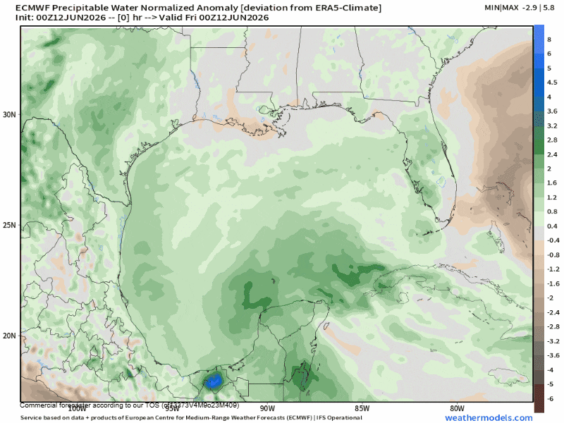
The National Weather Service’s Weather Prediction Center is indicating a slight risk of excessive rainfall for these areas starting on Sunday and bleeding into the northern Gulf Coast for the middle part of next week. This could lead to scattered, localized flash flooding from parts of eastern Texas to Louisiana, Mississippi, and Alabama.

Copyright 2026 by WPLG Local10.com - All rights reserved.
