

Author’s note: The taxpayer-funded tools from NOAA I consulted to provide the forecast information and analyses in today’s newsletter include data from the Multi-Radar/Multi-Sensor System (MRMS), developed and maintained by the National Severe Storms Laboratory (NSSL) in Norman, Oklahoma and wind analyses from the University of Wisconsin’s Cooperative Institute for Meteorological Satellite Studies (CIMSS). NSSL and CIMSS are just a few of the dozens of weather and climate facilities slated for elimination in NOAA’s 2026 proposed budget.
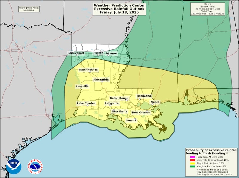
The disturbance dubbed Invest 93L washed ashore over Louisiana on Thursday, bringing widespread rainfall of 2 to 5 inches across much of southern Louisiana, with localized totals reaching double digits in the bayous of the Atchafalaya River basin north of Morgan City in coastal south-central Louisiana.
Mercifully, Louisiana was spared widespread, extensive flooding and only three flash flood warnings were issued statewide on Thursday from the heavy rains.
A flood threat remains over parts of Louisiana today through Saturday evening in 93L’s wake as residual rainfall could locally drop another 6 inches in places.
The remnants of 93L will get swept inland around the western periphery of a high-pressure system building over Florida this weekend. Though some forecast models show the scraps of 93L getting mixed up in yet another front digging into the southeast early next week, turning it into a recycled mess over the northern Gulf late next week, (re)development is unlikely.
Hurricane season off to a noticeably quiet start
Although we’ve seen some very serious flood issues from copious tropical moisture early this hurricane season, tropical systems so far have had trouble organizing or holding together.
In fact, despite three named storms so far in the Atlantic, more than the two we’d expect in an average season by this date, each has been short-lived and fairly weak. The overall hurricane season performance as measured by the season-to-date Accumulated Cyclone Energy or ACE is the lowest we’ve seen since the early season shutout of 2009 (a below average hurricane season held down by a modest El Niño).

Most of the activity so far this season has come from the subtropics, a more difficult pathway to tropical development that can mask the overall health of the tropics. It’s still early, and over 90% of the hurricane season lies ahead of us, but we’ll be eyeing the Atlantic a little more closely in the weeks ahead for changes.
As we’ve discussed in previous newsletters, a change in the upper-level wind configuration as August approaches may begin to scour away some of the more hostile conditions we’ve seen so far across the tropical Atlantic. For now at least we don’t see any strong signals for development over the next few weeks.
CLICK HERE to download the Local 10 Weather Authority’s 2025 hurricane survival guide.
Copyright 2025 by WPLG Local10.com - All rights reserved.
